Revere launches neighborhood study to address flooding from Belle Isle Marsh
Get AI-powered insights, summaries, and transcripts
Subscribe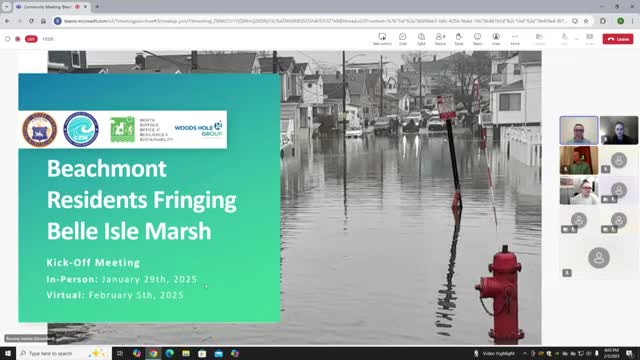
Summary
Revere and state partners described a study of flooding risks for Beechmont homes near Belle Isle Marsh, outlined data sources and timelines, and heard residents’ requests for near-term help such as sandbags and deployable barriers.
Revere City and state partners presented results of a new coastal flood-risk study for homes along the Beechmont edge of Belle Isle Marsh and solicited resident experiences and priorities at a public meeting. Kristen, the resilience manager for the North Suffolk Office of Resilience and Sustainability (NSOARS), said the outreach is intended to guide near- and long-term options for flooding that residents already report seeing.
The study team described why the Beechmont “gap” was selected and what it will examine. Connor Austin, coastal scientist at Woods Hole Group, said Belle Isle Marsh is protected and heavily studied: “Belle Isle Marsh itself is an open space, reservation managed by DCR state agency, and it is bordered by East Boston to the West, Beechmont and Revere to the North, and Winthrop to the South and East.” He and other presenters said the marsh is an Area of Critical Environmental Concern with rare habitats and critical infrastructure nearby, and that several projects already under way surround the Beechmont reach.
Project scope and timeline: the Woods Hole Group-led effort covers the Beechmont shoreline and adjoining residential streets (Pearl Ave, Summer St, Crystal Ave and Winthrop Ave). The team said it has completed a wetland resource delineation and a topographic site survey, is conducting a coastal flood-risk assessment, and will perform a cost–benefit analysis before presenting community-preferred alternatives at a May public meeting and in a final report. Rebecca Haney, coastal geologist with the Massachusetts Office of Coastal Zone Management, said the agency is funding the project: “We are funding this project and happy to support it.”
Data and what it means for residents: presenters showed FEMA Flood Insurance Rate Maps, the Massachusetts Coast Flood Risk Model (MCFRM), and projected mean high-water shorelines. The team said MCFRM outputs are framed as an ‘‘as soon as’’ year with roughly a 20-year interpretation window; for example, areas labeled 2030 are the start of a 20-year range when the model expects repeated flooding. Linnea Laux, climate resiliency specialist with Woods Hole Group, summarized the model outputs for the neighborhood, saying portions of Pearl Ave show very high annual flood probability under MCFRM scenarios and that mean-high-water projections indicate water reaching property lines by about 2030 and roads by 2050 in the model runs referenced.
Resident concerns and local experience: the meeting’s discussion was led by Revere staff and Woods Hole Group and drew numerous residents who described recurring flooding during storms and on high tides. One resident, Jim, said: “My one concern is you're using a baseline of 2008,” and asked whether that understates current sea levels. Presenters explained the 2008 baseline is used in some models because of tidal-cycle averaging and that MCFRM is intentionally conservative and intended for planning.
Residents described repeated, localized impacts: several attendees said the lowest portion of Pearl Ave floods frequently and that water depths range from one to several feet; some reported damaged vehicles and ground-level mechanical systems. Community members described ad hoc neighbor communications—text chains and door-knocking—to warn each other and move cars to higher ground. Attendees also reported that many homes use multiple sump pumps and that some renters have left because flooding made units untenable.
Options under consideration: presenters emphasized that no single ‘‘silver-bullet’’ solution will fit all properties. They said the study will analyze a suite of near-term and long-term measures. Near-term, lower-cost options discussed include community coordination on deployable flood barriers and expanded provision of sandbags. Long-term structural options such as raising roads, raising or elevating buildings, or installing storm surge barriers were discussed but described as costly, complex to permit, and likely to carry environmental trade-offs in the marsh. Connor Austin noted that a storm-surge barrier at the marsh inlet had been discussed previously but would have cascading environmental effects and would not stop flooding that enters the marsh from multiple directions.
Community requests and next steps: residents asked about parking alternatives, assistance with car relocation during flood events, and whether buyouts or other financial assistance might be available. Presenters said the state and partners are exploring options including a potential state-level buyout program but emphasized no mandatory relocations are proposed and that any buyout would be voluntary. The project team asked residents to submit photos and observations (via MyCoast and email) to supplement model data and said they will return in May with draft recommendations and a report.
Why this matters: the presentation linked local household impacts—damaged cars, loss of renter households, and repeated sump-pump use—to broader coastal-change projections for Revere and neighboring communities. The team framed the effort as a targeted technical study meant to produce specific, community-informed near-term actions and to identify where larger investments or regional coordination may be needed.
The study partners named during the meeting included Woods Hole Group, the Massachusetts Office of Coastal Zone Management (CZM), the Department of Conservation and Recreation (DCR), the Massachusetts Executive Office of Energy and Environmental Affairs (via the Municipal Vulnerability Preparedness program), the National Fish and Wildlife Foundation (NFWF), the Mystic River Watershed Association, Friends of Belle Isle Marsh, the MBTA and MassDOT, and Revere City staff. Revere staff and Woods Hole Group encouraged residents to watch for a joint public meeting on March 3 that will cover related projects around Belle Isle Marsh, and to expect a follow-up community meeting in May where the team will present study findings and candidate actions.