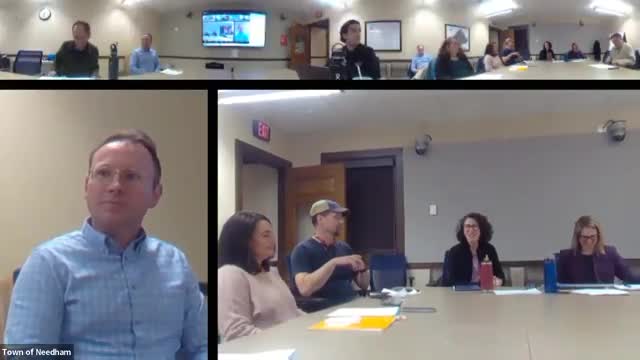
Needham creates Tree Preservation Planning Committee, elects leadership and outlines inventory, outreach, education work plan
Get AI-powered insights, summaries, and transcripts
Subscribe
Summary
The Town of Needham’s newly formed Tree Preservation Planning Committee elected leadership, reviewed the committee charge and near-term tasks including a partial street-tree inventory, LiDAR analysis, developer outreach and public education, and set a regular meeting schedule.
The Town of Needham on opening night formally launched its Tree Preservation Planning Committee, elected volunteer leadership by voice vote and set a work program that includes public listening sessions, a public-shade-tree inventory, LiDAR canopy analysis, developer outreach and education for residents.
The committee’s charge, read at the start of the meeting, directs the group to “review options for preserving the town’s tree canopy, both public and private, and make recommendations for action to the Select Board,” and to host early public listening sessions, evaluate funding sources including grants and community preservation funds, and recommend changes to rules, regulations and bylaws where appropriate (Heidi Trejo, vice chair, Select Board).
Members emphasized a goal-first approach rather than jumping straight to a bylaw. Katie King, deputy town manager and staff to the committee, said the group will start by clarifying goals and metrics before choosing strategies, including whether to pursue a private-tree bylaw modeled on other Massachusetts towns. Edward Olsen, superintendent of parks and forestry and the town’s tree warden, said Needham staff previously interviewed Massachusetts communities with tree bylaws and that some towns reported success while others did not.
Discussion and immediate tasks Committee members discussed short- and long-term workstreams the group will pursue. Staff and members said near-term activities include: bringing a Charles River Watershed Association presentation to level-set the committee on canopy science and mapping; building on a partial street-tree inventory completed with Bartlett Tree using a $10,000 appropriation; using LiDAR (light detection and ranging) to track canopy at a townwide scale; and developing outreach and education for homeowners and builders.
Edward Olsen described the completed partial inventory: “The Parks and Forestry was given $10,000 to perform a partial inventory. So we have completed that. We have that base layer on our GIS layer,” and said the work was done by Bartlett Tree around December and that additional town meeting funding could expand the inventory. Olsen also explained the difference between the two mapping approaches: LiDAR gives a high-level canopy measure, while a tree-by-tree GIS inventory documents street and public shade trees.
On the question of defining which trees are under town jurisdiction, Olsen referenced state law: “Anything in that road layout is considered a public shade tree under Chapter 87 Section 7 of Mass. General Law,” meaning the town’s jurisdiction covers trees within the public way.
Members discussed incentives, maintenance and alternatives to a strictly punitive bylaw. Several members urged a mix of strategies—education, developer engagement and incentives—rather than relying solely on mitigation fees that can incentivize removal. Builders and renovators on the committee described trade-offs among lot size, foundation placement and the practical limits to planting large species after redevelopment.
Outreach and data plans Committee members asked staff to assemble baseline data about Needham’s canopy and disparities across neighborhoods. King and Olsen said staff are collecting datasets and that the partial inventory will be added to the town GIS; Olsen estimated a full town inventory of public shade trees could cost on the order of $100,000, while a complete inventory of every private tree and wooded parcel would be far more expensive. The Charles River Watershed Association was invited to present at a future meeting and will share both local LiDAR-based canopy analysis and comparative data for towns in the watershed.
Scheduling, meeting rules and next steps Members agreed that the committee must comply with the Massachusetts open meeting and public records laws; staff reminded members not to use reply-all or private group chats for substantive committee business and offered to collect resources and examples on members’ behalf. The committee agreed on a regular meeting cadence (generally third Mondays at 7 p.m., with scheduling exceptions to avoid conflicts) and set an interim meeting for April 16 at 7 p.m. Staff will prepare a short form for members to summarize what work they are willing to do outside public meetings and will assemble example bylaws, reports and case studies from other communities for the next packet.
Formal action The committee voted by voice/show of hands to elect the two volunteers who had offered to serve as chair and vice chair. The motion was moved and seconded and approved; individual roll-call votes were not recorded.
What’s next Staff and members will collect baseline datasets, schedule the Charles River Watershed presentation, develop a plan for outreach to builders and developers, and prepare options for short-term actions the committee could recommend to the Select Board or staff in advance of a final report. The committee discussed aiming to provide an interim update to the Select Board later this year, while noting budget-related recommendations may need to be timed for the town’s fiscal planning process.
