Article not found
This article is no longer available. But don't worry—we've gathered other articles that discuss the same topic.
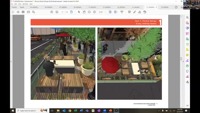
City staff outlines Mission Street road diet concept and seeks commission feedback
Parents press commission for more crossing guards and speed calming near Arroyo Vista Elementary; neighbors ask for speed cushions on Ramona Avenue