Article not found
This article is no longer available. But don't worry—we've gathered other articles that discuss the same topic.
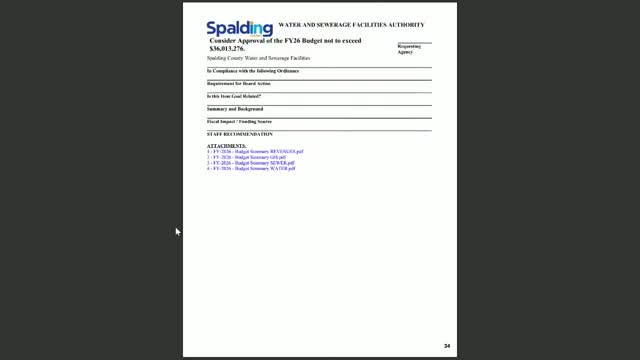
Votes at a glance: Spalding County Water Authority approves FY‑26 budget, PDB phase‑2 task order and multiple easement purchases
Water authority seeks clarity on community sewer trustee, service‑area maps and permitting
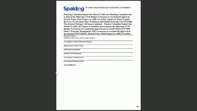
Developer to fund 20‑inch transmission main; authority will own pipe, planning committee says