Wildfire Hazard Map Sparks Controversy Among Local Landowners
August 07, 2024 | Wasco County, Oregon
This article was created by AI summarizing key points discussed. AI makes mistakes, so for full details and context, please refer to the video of the full meeting. Please report any errors so we can fix them. Report an error »
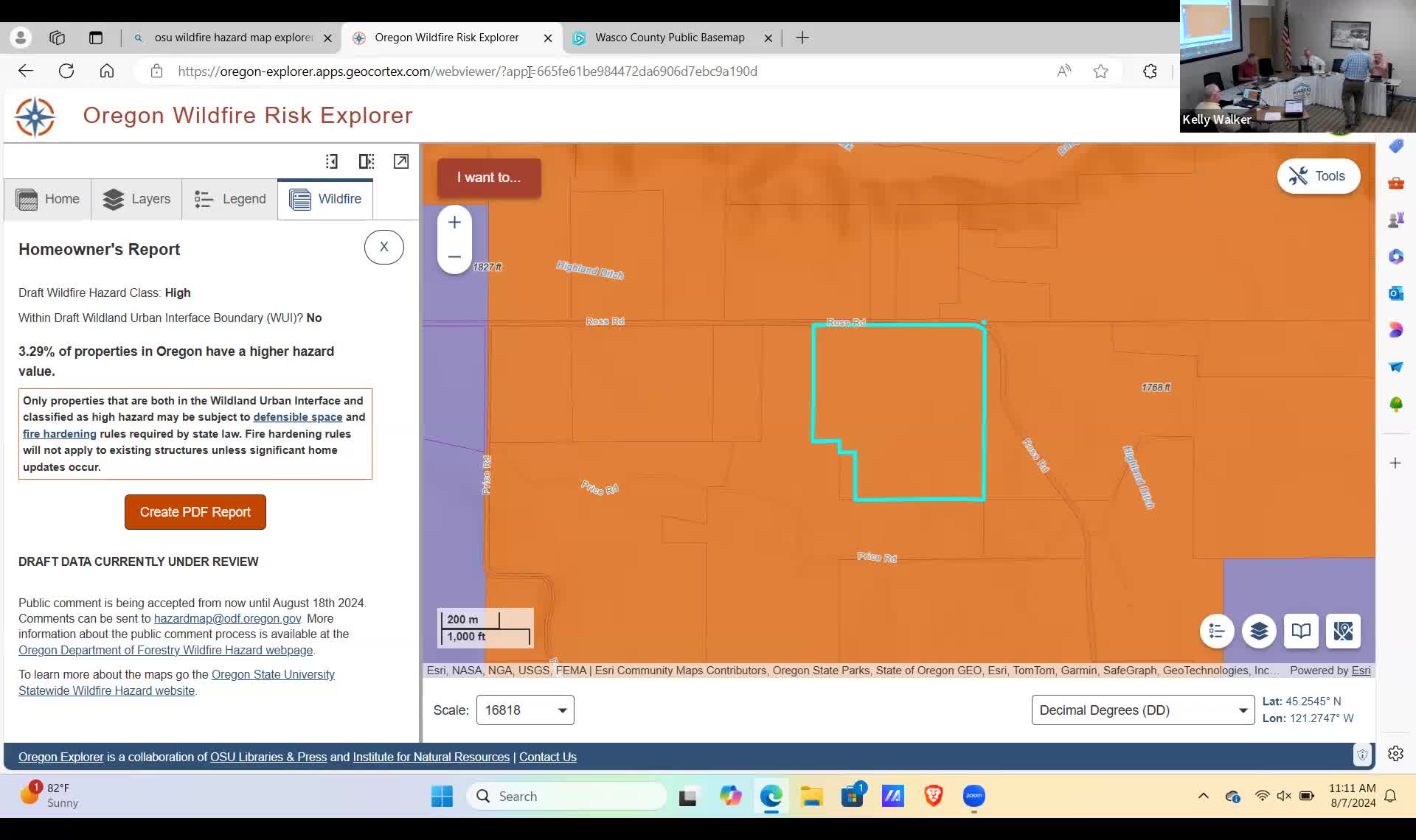
Derpitude noted that the map indicates high hazard zones for properties that have historically been well-managed and protected against wildfires. He emphasized the importance of local knowledge in assessing fire risks, arguing that the state’s approach lacks the necessary on-the-ground analysis. He shared his personal experience, revealing that his farmland, which has been irrigated and maintained since 1991, is now classified as high hazard despite its greenfield status, which has historically helped mitigate fire risks.
The discussion also touched on the potential regulatory impacts stemming from the new map, including new building permit requirements that have yet to be defined or adopted. Derpitude raised concerns about the lack of public hearings and community involvement in the mapping process, which has left many residents confused and unaware of how these changes might affect them.
The meeting underscored the need for clearer communication from state officials and a more collaborative approach to wildfire risk management that incorporates local insights and historical data. As the community grapples with the implications of the new wildfire hazard designations, the call for transparency and local engagement remains a priority among improvement district members.
View full meeting
This article is based on a recent meeting—watch the full video and explore the complete transcript for deeper insights into the discussion.
View full meetingSponsors
Proudly supported by sponsors who keep Oregon articles free in 2025

