Mapping Vulnerability in Urban Areas Reveals Redlining Impact
October 13, 2024 | Utah Department of Transportation, Utah Transportation, State Agencies, Organizations, Utah Executive Branch, Utah
This article was created by AI summarizing key points discussed. AI makes mistakes, so for full details and context, please refer to the video of the full meeting. Please report any errors so we can fix them. Report an error »
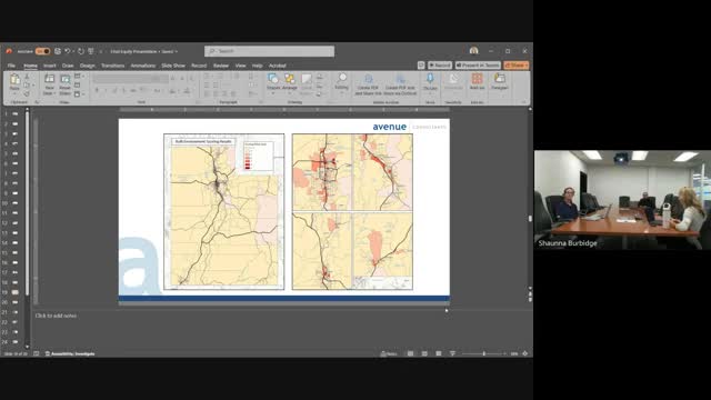
The analysis revealed that while only one area in Salt Lake City had nine built environment concerns, many urbanized regions exhibited four or more issues. The mapping utilized a color-coded system to indicate varying levels of vulnerability: areas with high social vulnerability index (SVI) were marked in orange, those with high built environment concerns in salmon pink, and regions exhibiting both vulnerabilities were highlighted in red.
Key clusters of concern were identified in the downtown Salt Lake Westside and parts of Utah County, including Old Town Provo. The analysis also extended to Ogden and St. George, where similar patterns emerged. This mapping provides crucial insights into where vulnerable populations intersect with built environment issues, enabling targeted interventions.
The meeting emphasized the importance of understanding the underlying factors contributing to these vulnerabilities. A significant focus was placed on historical redlining, which has left lasting impacts on community characteristics. The officials underscored that without a clear understanding of these contributing variables, effective solutions cannot be developed.
This analysis not only sheds light on the current state of urban vulnerabilities but also serves as a foundational step towards addressing systemic issues within these communities. The findings are expected to guide future policy decisions and resource allocation aimed at improving the living conditions in these identified areas.
View full meeting
This article is based on a recent meeting—watch the full video and explore the complete transcript for deeper insights into the discussion.
View full meetingSponsors
Proudly supported by sponsors who keep Utah articles free in 2025

Excel Chiropractic

